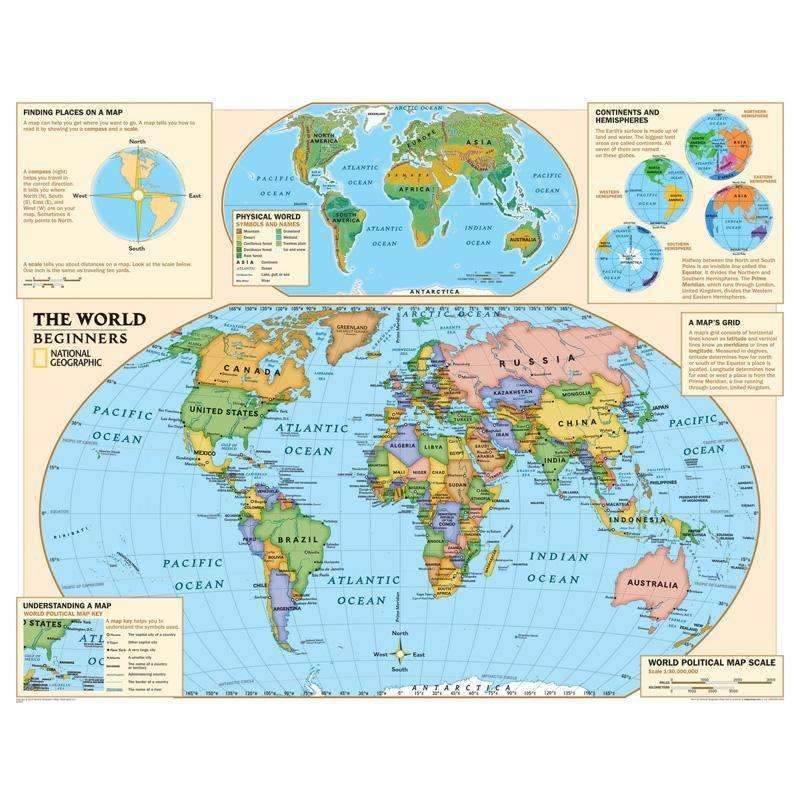
Beginners World Map NATIONAL GEOGRAPHIC MAPS
$ 29,99 $ 17,99
This is a very exciting year for National Geographic Maps, as we are launching our new series of maps designed specifically for the kids. Our new graded-series of maps are the first to address the unique needs of K-12 students as they advance their understanding of our World.
Unlike other classroom poster maps, ours utilize the Winkel-Triple projection, which provides the best combination of size, shape, and distance giving the student the best visual representation of the Earth’s surface. This solves the effect seen on other maps where Greenland appears larger than South America.
Our new maps start early elementary kids off right. Our Beginner Series, grades K-3, contains an easy to read maps of the World and United States.
Scale = 1:30,000,000
Fast Shipping with Professional Packaging
Our long-standing relationship with UPS FedEx DHL and other carriers around the world allows us to offer various shipping options. Our warehouse staff are highly trained to package your goods exactly as per the specifications we provide. Your goods are thoroughly checked and secured properly prior to shipping. We ship to hundreds of thousands of customers daily in different countries. The fact that we're dedicated to becoming the largest online retailer in the World is obvious. Warehouses and distribution centers are located in Europe as well as the USA.
Please note that orders with more than one item are subject to a processing period that is based to the specific item.
Before shipping, all ordered products will be thoroughly inspected. Most orders are shipped within 48 hours. The time to deliver varies from 3-7 days.
Returns
The stock is dynamic and we do not completely manage it because multiple stakeholders are involved, including our warehouse and factory. The stock can change at any moment. Be aware that your order will be unable to fill once you've placed your order.
Our policy runs for 30 days. If you don't receive your product within the 30 days period, we are not able to provide a refund or an exchange.
The item must not be used, and it must be in its original condition. The item must be in its original packaging.
Related products
Learning Materials
Learning Materials
Learning Materials
Learning Materials
(12 Ea) Black Polka Dots Incentive TEACHER CREATED RESOURCES
Learning Materials
Learning Materials
Learning Materials
Learning Materials
Learning Materials
Learning Materials
Learning Materials
(10 Ea) Substitute Teacher Folder SCHOLASTIC TEACHING RESOURCES
Learning Materials
Learning Materials
Learning Materials
Learning Materials
Learning Materials
Learning Materials
Learning Materials
Learning Materials
Learning Materials
Learning Materials
Learning Materials
Learning Materials
Learning Materials
Learning Materials
Learning Materials
Learning Materials
Learning Materials
Learning Materials
Learning Materials
Learning Materials
Learning Materials


